|
Event
One-day Workshop on Drone Data Analytics in Agriculture
One-day workshop covers basics of photogrammetry, best practices in UAS imagery data collection, theory and hands-on training on data analytic methods while analyzing actual agricultural data (case studies). Highlight is the hands-on training by certified industry staff trainers to educate participants with available commercial (e.g. Pix4D Mapper & Fields) and free open source (QGIS) data analytics software(s).
Agenda
Topic 1: Best practices in UAS imagery data collection. Basics of photogrammetry with overview of available multi-spectral, thermal-infrared and Time-Of-Flight optical sensors. Learn about meaningful and quality data collection steps such as i) calibrating and configuring sensor(s) to log needed metadata, ii) setting up field ground control points, and iii) planning the UAS flight mission,
* Walk out to near by field site and do a planned data collection mission
Topic 2: Overview of data processing tools and basic data analysis steps. Learn basics about radiometric, geometric corrections and image stitching; special, spectral and radiometric image enhancements; vegetable indices maps generation and interpretations; supervised and unsupervised data classification and generating prescription maps for crop production management .
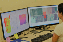
Topic 3: Hands-on training using commercial Pix4D (Mapper and Fields) software. Using real agricultural data (case studies) get step-by-step hands-on training on how to analyze, store and visualize data layers. How to do zonal statistics and generate prescription maps. Also, learn about proper data handling issues.
Topic 4: Hands-on training using open source QGIS software. Using real agricultural data (case studies) get step-by-step hands-on training on how to analyze, store and visualize data layers. How to do zonal statistics and generate prescription maps.
Topic 5: Drone data use in agriculture (case studies). Through several case studies, we will go over meaningful data capture, analysis and use of such approaches in agricultural production management as well as in high throughput crop phenotyping applications.
|
|
 |
LocationAg Tech Building, WSU IAREC (View)
24016 N Bunn Rd
Prosser, WA 99350
United States
Map is loading...
In order to see the map for this event, click the Privacy icon in the lower left corner of your screen and grant consent for Google Maps.
The Privacy icon looks like this:

Categories
| Kid Friendly: No |
| Dog Friendly: No |
| Non-Smoking: Yes! |
| Wheelchair Accessible: Yes! |
|
Contact
|