|
Event
WNYGIS Spring 2016 Meeting (Free Event)
The WNY GIS Users Group will have Five Presentations on Wednesday May 25th, 2016.
Event Location:
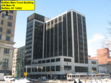
Main Court Building
Sunburst Room, C104
438 Main Street
Buffalo, NY 14202
Time:
4:30 - 6:30pm
Presentations:
Matt Balling - New York State DOT
Integrating snowfall forecasting data into the Incident Command System Situation Unit of NYSDOT during severe winter weather events.
Mike Koterba and Mike Pianka - MJ Engineering & Surveying
How GIS and mobile 3D LiDAR scanning are being used in conjunction to revolutionize the capture of 3D data in a process known as Mobile Mapping
Robert E. Gehrer - NYS GIS Program Office
Centralizing Data Outreach for the Statewide Parcel Map Program.
Brian Conley - UB Regional Institute
Envision Tomorrow software with ArcGIS.
J. Scott Hawker Rochester Institute of Technology
Using GIS for optimized shipping (impacts to CO2/No2/Time).
The event is free and refreshments will be served.
MaptimeBUF meeting to follow at the nearby Pan-American Grill (2min walk), all are invited, hors-doeuvres will be provided.
|
|
 |
LocationBuffalo Main Court Building - Sunburst Room, C104 (View)
438 Main Street
Buffalo, NY 14202
United States
Map is loading...
In order to see the map for this event, click the Privacy icon in the lower left corner of your screen and grant consent for Google Maps.
The Privacy icon looks like this:

Categories
| Dog Friendly: No |
| Non-Smoking: Yes! |
| Wheelchair Accessible: Yes! |
|
Contact
|