|
Event
Regrarian Farm Design & Keyline Summit w/ Darren Doherty
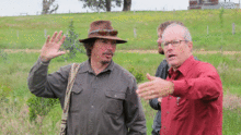
Darren Doherty is coming to Afton, Virginia, Nov 5-7th, for a 3-day Open Consultancy and Keyline intenstive! If you're serious about becoming a farmer, improving the success of your current farm, or becoming a farm consultant, this is truly the course for you. Come spend 2 days going through Darren's consultation process, followed by a full day on Keyline design, featuring Peter Traverse.* You'll learn to use the Regrarian platform to read a landscape like you've never seen it before, witness a keyline plow in action, hear about a revolutionary new online platform for managing your farm, ask your questions to the world's preeminent farm designer, and much more. Invest in the success of your farm and your ability to manage it. Darren's course will help you avoid common pitfals, while exposing you to the best practices he's seen across the 40 countries in which he's worked.
Day 1-2: REGRARIAN OPEN CONSULTANCY (RAC)
Regrarian Open Consultancy (RAC) is a dynamic 2 day program designed to involved participants directly in the delivery of an integrated farm planning and development consultancy. Led by one of the world's most renowned & experienced farm planners, Darren J. Doherty (AU), the RAC is all having participants work to understand the 10 step process logic involved with the 'Regrarian' Platform which methodically covers each and every element of farm planning and development. In short the RAC is a Professional Development (PD) for primary producers when it comes to production landscape & enterprise planning & development. The RAC experience will result in participants understanding some of the process behind re-booting their own farming enterprises with a step by step approach that is highly adaptable to their own circumstances.
Day 3: KEYLINE SUMMIT w/ Darren feat. Peter Traverse
Keyline and Fertility Farming intensive
*Learn Keyline Geometry in the field
*Survey and Layout Keypoint and keyline patterns
*Identify strategic placement of dams/ponds
*Learn how to use a keyline plow
* Learn about Myobservatory.net, the revolution in environmental information management.
*Hear what groundbreaking research on Keyline design is being done at Inisfree Village, under the Direction of Peter Traverse.
RAC PROGRAM
DAY 1
A 1. Climate (25 mins)- Discuss the client's Holistic Concept (including Financial Plan)
A 2. Geography (20 mins) Go over their pre-prepared Aerial Photo/Contour Base Map pointing out specific geographic features
(If we dropped the Regrarian presentation then we'd make the Climate & Geography sessions 60:30 or 45:45 mins respectively).
B Farm Walk n' Talk
Walk the farm and point out specific areas of concern good to do after lunch however its good to get this out of the way early so that people can get the fresh context of Climate & Geography.
C 1. Debrief from the morning (15 mins)
2. Geography (10 mins) any additions to the Base Map from the walk?
3. Water (65 mins) Design the Water layer A. Catchments, B. Harvesting & Storages (continue session D)
D 1. Water (45 mins) Design the Water layer (continued) C. Reticulation D. Irrigation
2. Access (45 mins) Design the Access layer A. Roads B. Tracks
DAY 2
A 1. Debrief from the Day 1 (20 mins)
2. Forestry (70 mins) Design the Forestry layer A. System Identification B. System Layout
B 1. Buildings (45 mins) Design the Building layer A. Building types B. Placement
1. Fencing (45 mins) Design the Fencing layer A. Fencing types B. Placement
C 1. Debrief from the morning (15 mins)
2. Soils (90 mins) A. Determine the various soil treatments for respective systems B. Introduce the HM Grazing Plan & Aide Memoire
D 1. PolyMarketing (60 mins) Discuss the options for A. Processing, B. Logistics, C. Marketing
2. Energy (30 mins) What energy production systems are appropriate and where?
3. Closing (30 mins) A. Overview of the process and outputs B. Where to from here?
DAY 3 Keyline Summit, feat. Peter Traverse of myObservatory*
Schedule TBA
REGRARIANS PLATFORM:
1. CLIMATE - You, Enterprise, Risk, Weather
2. GEOGRAPHY - Landform, Components, Proximity
3. WATER - Storage, Earthworks, Harvesting, Reticulation
4. ACCESS - Roads, Tracks, Trails, Markets, Utilities, People
5. FORESTRY - Blocks, Shelter, Savannah, Orchards, Natural
6. BUILDINGS - Homes, Sheds, Portable, Yards
7. FENCING - Permanent, Electric, Cross, Living
8. SOILS - Planned Grazing, Minerals, Fertility, Crops
9. MARKETING - Analysis, Strategy, Value Chain
10. ENERGY - Photosynthesis, Generation, Storage
*Peter Traverse, farmer, Keyline researcher, and founder of myObservatory:
myObservatory is first and foremost an environmental information management system. Originally designed for agricultural use, it's useful with virtually any type of data. It does this by combining Geographic Information System (GIS) tools with data management and visualization tools. This allows you to:
Identify your area of interest (anywhere on the globe) and map those locations using GIS mapping tools for easy reference
Harvest public information (such as local, regional, and even global data)
Collect your own data through field observations using citizen science tools, sensors and customizable collection forms. This information is tagged with location information so that it shows up on your map
Make connections with all the information that applies to your place
Ask your own questions and seek answers about the place around you
Share and collaborate with others about what you learn
Focusing on the map of your place of interest as the primary interface allows you to add and find information by simply exploring your place of interest visually. Activating map layers that are connected to data lets you drill down into information in a more intuitive way. As you identify various data, you can chart multiple lines of information on a graph to see correlations and trends.
myObservatory is used in university ecology curriculum. Independent researchers use myObservatory as a scalable cyber-infrastructure for their research. It is used by farmers to track information about livestock grazing and land responses to innovative land practices. In short, myObservatory acts as a citizen science platform that provides the framework and structure to enable a method of investigation into your place of interest. myObservatory helps you observe and learn about the place that means the most to you: your place.
|
|
 |
LocationBlue Ridge Regrarians Hub (View)
40 Farfields Ln
Afton, VA 22920
United States
Categories
Contact
|